After watching the weather for a couple of weeks, we were finally able to make the passage from the Dominican Republic to Puerto Rico. To get to Puerto Rico, we had to cross the dreaded Mona Passage.
Why is the Mona Passage dreaded?? The Mona Passage is a strait that separates the islands of Hispanola (Dominican Republic and Puerto Rico). The Mona Passage connects the Atlantic Ocean to the Caribbean Sea and is an important shipping route between the Atlantic and the Panama Canal. The 80 mile stretch of sea between the two islands is one of the most difficult passages in the Caribbean. It is fraught with variable tidal currents created by the large islands on either side of it, and by sand banks that extend out for many miles from both coasts.
When planning a trip from one island to another, watching the weather is the key to have a safe and comfortable passage. We use several tools to help us plan our passages.
First and foremost, is access to good weather information. Our go-to weather consultant is Chris Parker. Chris is a weather guru who has a weather forecasting service which provides weather info and routing advice mainly to small private yachts. He transmits on the single side-band radio at specified times during the day and you can listen to his transmissions for free. Another option is to subscribe to his yearly service and receive customized weather for your boat by calling in via SSB during his scheduled transmissions.
If you have e-mail access, Chris will send customized weather and routing advice for a one time fee. For our passage to Puerto Rico, we paid $55 for a customized weather report.
Here is Chris's e-mail to us for our trip:
CWF2 - Depart: OceanWorld, DR - To: Boqueron, PR -Genesis - Shannon 38 Cutter
Nice mild, settled weather this morning, with no significant squalls.
Since we spoke, the ASCAT satellite wind observations arrived, and show nice moderation has established. Last evening at 10pm wind was ESE@17+ along the DR's N Coast...but by 10am this morning conditions have settled to ESE-SE@7-12...and the only area seeing more wind than
this is in the W Part of Mona Psg, W of Mona Island, where it's ESE@13-16.
Strengthening ColdFRONT in SE Bahamas has caused the wind-gradient to slacken in your area, and this should persist thru much of Mon Jan 20...so I think you're good-to-go today, Sat 1/18!
During Mon20 afternoon, the Frontal TROF N&W of you weakens, and allows some rebuilding of ENE-E Trades....and Trades from N-of-E can funnel thru MonaPsg, causing wind velocity to increase more than expected. So...it's best if you can arrive in Boqueron no later than Sunset
Mon20, so that you're within about 20-30mi of the W Coast of PR from mid-afternoon onward.
FORECAST:
This afternoon: sea breeze may support 10-15k ESE winds, wind-chop 2-4'. Swell 5'/10-11secENE.
Tonight, passing 70W: mostly ESE under 10k, may fall L&V, wind-chop 0-2'. Swell 5'/11secENE-E.
Sun Jan 19, passing Cabo Samana: ESE under 10k, may run 10-13k in the afternoon sea breeze, wind-chop 2-3'. Swell 4'/10secENE.
Sun19 night- Mon 20 morning, in Mona Psg: wind should back E@6-10, wind-chop 2'. Swell 4'/10secENE, and also 4'/11secN-NNE.
Mon 20 afternoon builds, from 080@10, 2' early afternoon to 070@15g20 late afternoon or around Sunset...but you should remain in 10-14k range within 20-30mi of PR Coast throughout Mon 20 afternoon. Swell 4-5'/8secENE, and also 4-5'/11secN-NNE.
I suggest close to a rhumb line from E DR to PR...given the very-mild conditions most of the trip, but tendency to build wind/seas the later you arrive on Mon20, spending many hours traveling substantially N of your rhumb line will not be of great benefit if it means a later arrival Mon20. I would try to avoid HourglassShoal, but not deviate farther from the rhumb line.
Other weather sources:
When we have access to the internet, we have several internet weather sites we use to plan our passages.
Passage Weather is our go-to site for looking at wind speed and direction. Here is an example of what we are looking at when we use Passage Weather. The light blue areas are winds in the 10-15 knot range (good), darker blue is 15-20 knots (still good), green is 20-25 knots (getting worse) and lime green is 25-30 knots (not leaving!). The direction of the arrows is the wind direction (shown here is out of the east). The prevailing winds where we have been traveling since we left the Bahamas are out of the east. What does this mean? The winds are right on our nose and we have to motorsail to travel instead of sailing. Passage Weather gives us a 7-day snapshot of the weather we will see for traveling, with the most accurate weather is the first 3 days of the snapshot.
Another weather site we use is Windfinder. Windfinder shows the wind speed, wind gusts and wave height. Wave height is particularly important in planning a comfortable passage.
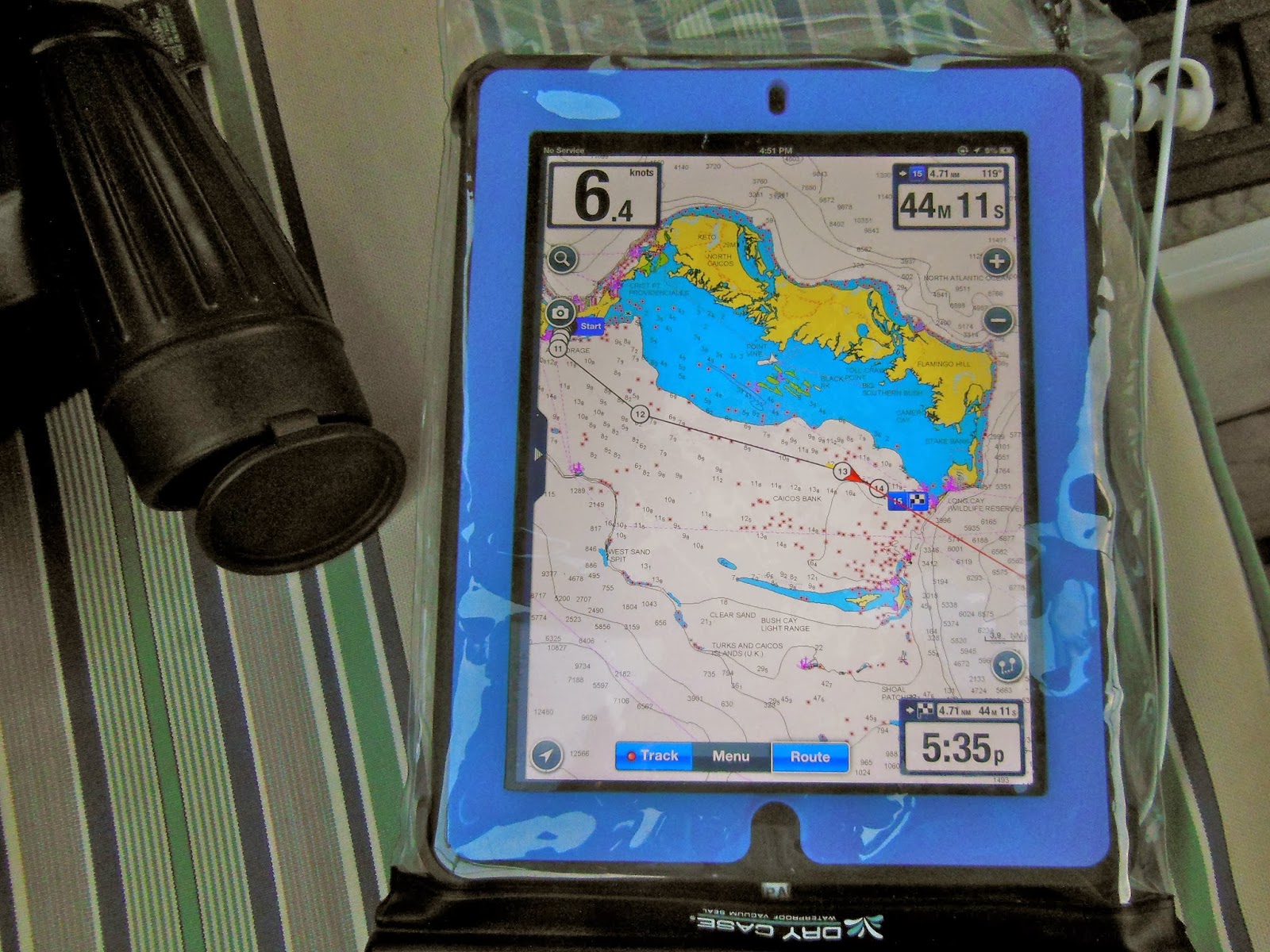
After getting a good weather window, the other phase of trip planning is plotting the trip route. We start out by plotting our course on our iPad using a Navionics app.
This allows us to plan the trip and determine how long we anticipate the trip will be in hours. If we are motorsailing, we calculate our fuel consumption in gallons. Our Yanmar 53hp engine averages about 1.3 gallons/hour of fuel consumption. We have a 60 gallon fuel tank and keep 25 gallons of diesel on deck. This will allow us a maximum of 110 hours of travel time or 600 miles of travel. Of course, we never cut it that close! One day soon, we will finally get into the trade winds and we will begin sailing!!!!
Our trip from Ocean World Marina in Puerto Plata, Dominican Republic to Puerto Real, Puerto Rico was estimated using our iPad to be 40 hours, traveling 5.5 knots/hour, 235 miles, using 52 gallons of fuel. The reality....We made better time traveling an average of 6.1 knots in 38.4 hours, used 53.8 gallons of fuel, and traveled 235.7 miles. Pretty good app!
 As we are traveling, we also use our Garmin 4210 chart plotter that is installed in our cockpit next to the wheel. We plot our route as we go on this chart plotter and have this integrated to our autopilot so that the boat is steered automatically to the course as we travel.
 This is a close up of the Garmin chart plotter. There is a little icon on the chart that shows the position of our boat. A dotted line shows where our boat has traveled. A magenta line shows the plotted course and a hash- marked line shows the boat's actual course. We check this chart plotter throughout the trip to verify our position and make sure we are still on course.
 And of course, we love our Standard Horizon VHF/AIS system that has the AIS (Automatic Identification System) integrated to our Furuno radar. This helps us identify commercial ships in our area, out to a 15 mile radius. It's really easy to look at the VHF display in the cockpit.
 The little open circle is a ship less than one mile away from us, the center black triangle. If I press the "LOC" button on the VHF, I can see the ship's name, the speed the ship is traveling (SOG) and the course the ship is traveling (COG).
 I'm keeping an eye on this ship as we pass by. So much easier to see what's going on during the day! Some sailors we have met boast about sleeping at the helm.. saying "what are the chances of a ship running me down out on the big, big ocean??". I say, from what we've experienced, it's not a chance we want to take! We've had too many close encounters already where we needed to alter our course!
 The ship I am tracking here is REALLY, REALLY close to us, but we are traveling in the opposite direction. The AIS feature of our VHF is invaluable to us as we travel, particularly at night. I usually have the range set for 15 miles. It can be set to alarm if a ship comes within a particular distance from our boat, which I usually have set for 10 miles. A large ship traveling fast can reach you pretty quickly!
Here are our various instruments mounted in the cockpit. All of these are used for a successful passage. We monitor the water depth, the wind speed and direction, the compass heading, and monitor the boat engine looking at RPM, oil pressure and engine temperature.
Starting at the top left and going around clockwise...
B&G Depth instrument (shows depth in feet) (We draw 6 feet, stay in 8 ft or >)
Wind Gauge (shows wind direction and speed)
Furuno GPS 31 (battery charge, boat speed in knots, nautical miles traveled, and compass heading)
Yanmar engine gauge (shows engine RPM speed)
Standard Horizon GX 2150 VHF/AIS
VHF microphone
electrical cord plug (connects boat to shore power at dock)
engine oil pressure gauge
engine temperature gauge

Captain LA at the helm.
One of my favorite passage past times... Napping during the day with LuLu!
Dawn breaks and I just came up to the cockpit to start my watch.
So, how was our passage to Puerto Rico? It started out rough! When we left the Dominican Republic, we had big swells for the first 10 hours. When we reached the coastline around Cape Samana, DR, the seas began to settle. The Mona Passage was very kind to us. We had winds in the 7-10 knot range and minimal swell. We chose our weather window well and it paid off!

Land Ho! We reach the western coast of Puerto Rico at dawn!
Another passage completed and we are ready for some fun!